The Goal of the project work was to get experience on using Handheld GPS devices, as well as working with the Software Trimble Pathfinder Office and Erdas Imagine LPS to generate an Orthophoto and a digital elevation model out of 6 aerial pictures and some additional data sources.
The aerial pictures are originally film-type, but have been provided already scanned to a digital format. As the pictures are already historic, there was also the challenge to find the pictured scenery in real life. Therefore it was essential to go well prepared into the field without the risk of doing false measurements as this could lead to a second try for the field work.
Data Processing:
The data was processed in the ERDAS Imagine 2013 toolbox “Leica Photogrammetry Suite” (LPS). For projection variables the horizontal projection was set to BMN M31 (EPSG:31258), the vertical projection was set to the Bessel spheroid with the MGI (Hermannskogel) date. As for the camera calibration information an average flying height of 3800m was chosen. This reflects the average flying height of the plane of 4700m above sea level in combination with the average elevation of the study area. Additional camera calibration information was retrieved from an calibration file in .cam- format.
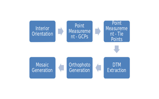
After entering this first set of information about the coordinate reference system and the recording-parameters, the workflow as shown was used.
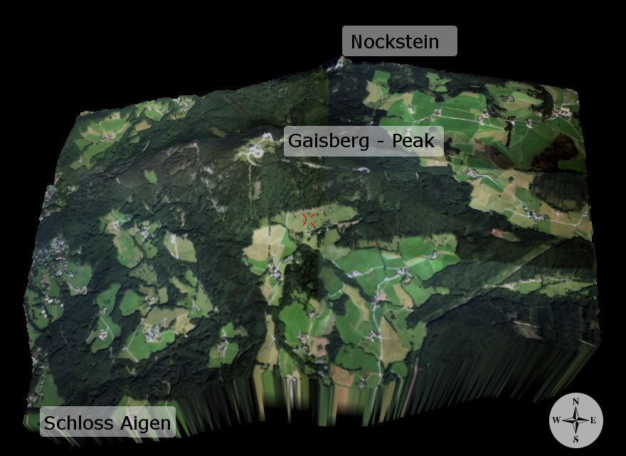
Result
The final result of the project is the mosaicked orthophoto, overlaid onto the generated DTM. The final output covers the area around the Gaisberg. In the northeast, it is just missing out the main parts of the villages of Schnurnn and Koppl. As for the southwest, it shows the buildings close to “Schloss Aigen”.